|
||
|
Brian's "Picture of the Week" |
||
|
IMAGE: Cape Town's Table Mountain |
||
|
|
BrianWhittaker.com |
||||
|
|
||||
|
||
|
Brian's "Picture of the Week" |
||
|
IMAGE: Cape Town's Table Mountain |
||
|
|
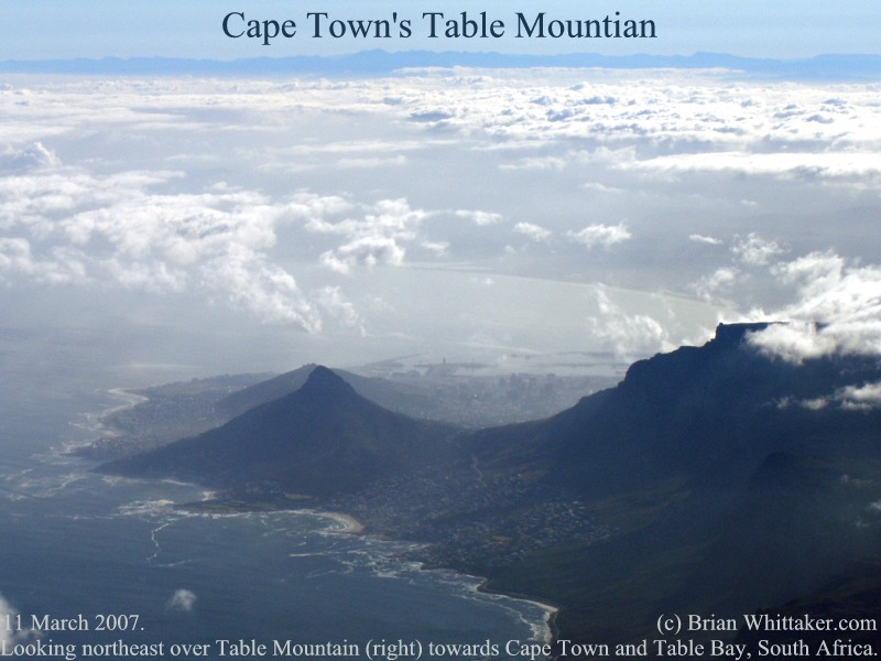
The
port city of Cape Town (centre) [City]
is
visible beyond and between well known flat topped Table Mountain (centre
right)
[Table
Mountain] and
Lion’s Head (left) in this northeast looking aerial view. Still further
onward are Table Bay and the South African mountainous mainland, with
Robben Island just outside the photo to the left. As can be seen today,
rougher seas constantly pound the exposed western shores (lower left). Contrary to popular
misunderstanding, Cape Town is neither at the southern tip of Africa, nor faces south towards the open sea. The city of 3
million faces north towards its uniquely sheltered harbour at the
northern end of Cape Peninsula [National
Park].
Near the southern tip of this local peninsula is
the infamous Cape of Good Hope
[Cape],
known for causing treachery to early shipping. Visible as a little spot on
the left side of 3300 foot high Table Mountain is the top of the “Table
Mountain Aerial Cableway” [Cable
Car] which
offers exceptional views of the local area. Photo: Airborne
near 10,000 feet over South Africa. -34'S/018'E [Map].
Olympus C70z. 11 March 2007, 0700 UTC. [800x600] Photo: (c)
2007 Brian Whittaker (.com) |